From time to time I find an article that I have to post(Hey its my blog,I can post what ever I want).This may or may not relate to the lake.
This is one of those times.
I love the Kennebec river,paddle it or fish it,always a great time.
Sunday, May 18, 2003
Kennebec River: Waterville to Augusta
By Michael Perry
Paddle name: Kennebec River: Waterville to Augusta
Nearest town: Waterville
Region: Kennebec
Water type: River
Difficulty: Intermediate
Length: 8-17 miles, depending on take-out
Put-in: Waterville boat launch facility just upriver of the Donald V. Carter Memorial Bridge on river right. Refer to the Delorme Maine Atlas and Gazetteer maps No. 21, No. 13, and No. 12 for help in getting to the launch site and down to Augusta.
Take-out: Augusta boat launch facility on river left a few yards below Old Fort Western. For a shorter trip take out at the Sydney boat launch facility on river right, eight miles south of Waterville.
Other: The trip can be shortened by taking out at the Sydney boat launch facility on river right, eight miles south of Waterville.
Maps:
Get driving directions from MapQuest.
View a topo map from Maptech MapServer.
Paddle with the flow of history, past and present, down the Kennebec River from Waterville to Augusta and enjoy great wildlife viewing all along the way. As the swift current carries you south to Augusta, imagine Benedict Arnold's ill-fated march to Quebec in 1775 against the flow to Norridgewock, and think of a river tamed by the Edwards Dam from 1837 to its precedent-setting removal in July 1999. You are now paddling a river running free and wild once again from Waterville to the sea.
It is a 17-mile paddle from the Waterville boat launch facility on river right just upriver of the Donald V. Carter Memorial Bridge to the Augusta boat launch facility on river left a few yards below Old Fort Western. The trip can be shortened by taking out at the Sydney boat launch facility on river right, eight miles south of Waterville. Spot a vehicle on either end or be creative. We turned our excursion into a two-sport exploratory by leaving our bikes at a helpful local citizen's house in Augusta and biking back to Waterville via Route 201. Refer to the Delorme Maine Atlas and Gazetteer maps No. 21, No. 13, and No. 12 for help in getting to the launch site and down to Augusta.
Plan your outing with an eye on the weather and wind direction. If you have the flexibility, wait until there is a north-northwesterly wind. Coupled with the swift springtime flow of river, you will fly along. We paddled on a recent Saturday morning with a 20-knot tailwind that had us in Augusta after only three hours of paddling at a relaxed pace. A stiff southerly wind would have extended our paddling time and exertion levels considerably.
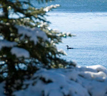
Hundreds of swallows darted over the water in pursuit of recently hatched insects as we headed out into the river. Their white underparts flashed brilliantly in the mid-morning sun. The paddling was effortless and as we passed by the Carter bridge abutments we were astounded how fast we were moving.
A bald eagle circled overhead, white head and tail feathers brilliant against the clear blue sky. The removal of Edwards Dam was justified in part by the prospects of migratory fish returning to their historical spawning grounds in the freshwater streams north of Augusta. More fish will bring more fishermen and more dollars, and also more birds to feed on those growing populations of fish.
Two more eagles appeared a few miles downriver, and we wondered if the day would soon be here that eagles in Maine would be as common as eagles are today in Alaska. Osprey, hawks, and turkey vultures took turns entertaining us as the miles flew by. We spent as much time looking skyward as we did down river.
South of Sydney a number of logging piers dot the edge of the river, tilting downriver and slowly decaying from their decades of use in corralling and directing logs down the river. The last log drive on the Kennebec took place in 1976. Since then the river has undergone a true reincarnation, slowly returning to a cleaner and wilder state.
Seven-Mile Island is the only island you will pass by on the Waterville-Augusta portion of the Kennebec. Located just north of the Augusta city line in the town of Vassalboro, it sits like a chockstone in the middle of the river with rushing waters flushing by on both sides. North of the island 14 large, 20-foot by 20-foot piers extend up the river. They are massive and look like a line of large, roofless log cabins filled with rocks. We were awestruck watching the water sweep around them, creating powerful eddies and current lines. Unless you eddy out behind one you will be by them in a flash.
The island and pier works, with their boom chains attached, provided one last spot to harness, control and delay logs on their last few miles of journey to the Augusta mills. "The Seven-Mile Island piers are the last impressive set of piers you'll see on the whole Kennebec," forester and historian Marc Johnson says. We were impressed.
A few miles north of Augusta we caught the first glimpses of civilization. Up to that point we had enjoyed an uninterrupted corridor of riverside trees just starting to display their fresh spring leaves, with no homes and development anywhere to be seen, except railroad tracks paralleling river left.
The dramatic outline of church steeples and the state Capitol building filled the horizon. Feeling as free and exhilarated as the river, we hurtled down through the waters cascading through what once was the site of Edwards Dam. We were suddenly overcome with a feeling of deep gratitude for the state and federal agencies and members of the Kennebec Coalition whose foresight and hard work helped bring about the reality of a free-flowing Kennebec south of Waterville. From put-in to take-out it had been a privilege to have paddled a free river once more, and to see firsthand how this grand river has responded to the removal of Edwards Dam. Come see and feel it for yourself this spring.
Canoeists and kayakers exploring this stretch of river should be proficient paddlers. In the summertime, at normal water levels, there are a few short Class I-II stretches. An 1824 War Department survey listed five miles of rapids in this stretch of river: Petty's Rapids, Six-Mile Falls, Bacon's Rapids, Babcock's Rapids and Coon's Rapids.
Michael Perry is the former director of the L.L.Bean Outdoor Discovery Schools and founder of Dreams Unlimited, specializing in inspiring outdoor slide programs for businesses, schools, and civic groups.
Subscribe to:
Post Comments (Atom)
No comments:
Post a Comment